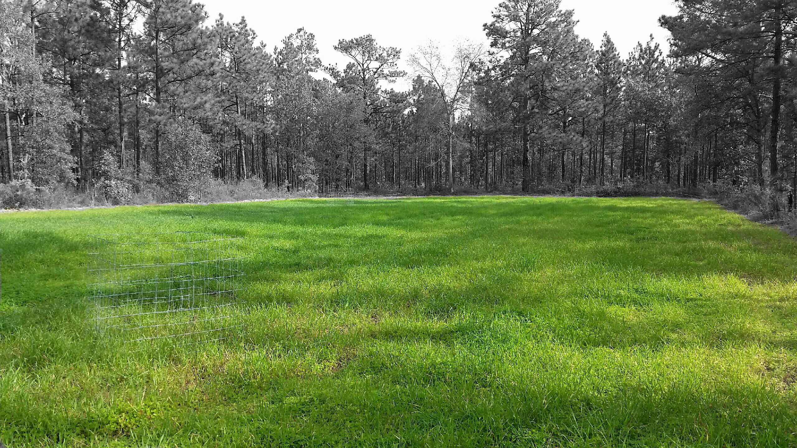
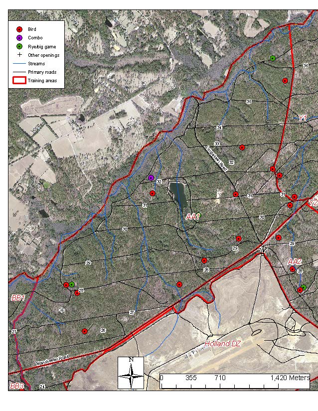
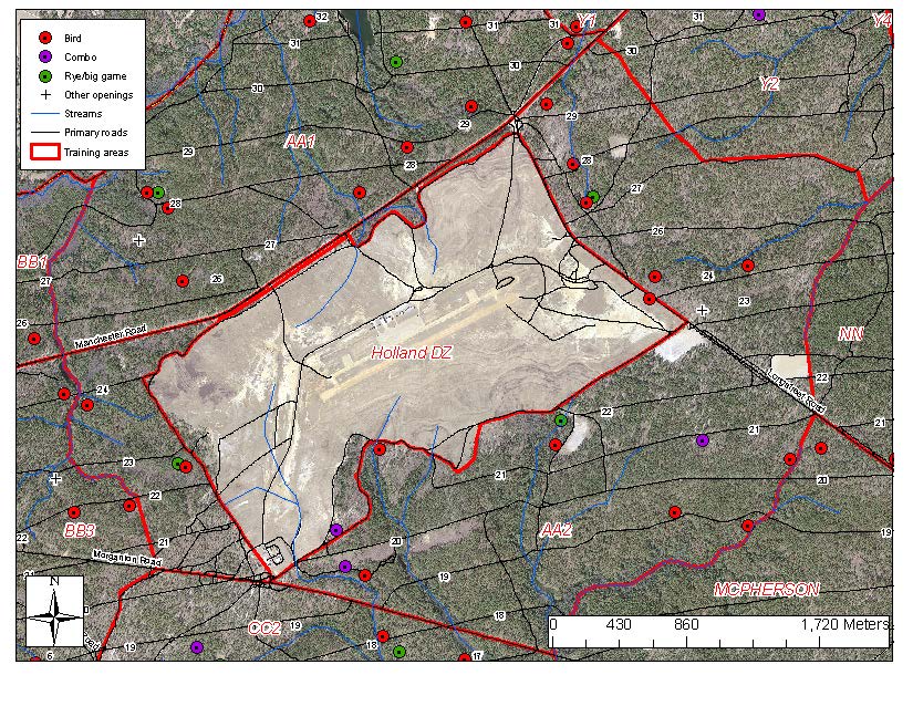
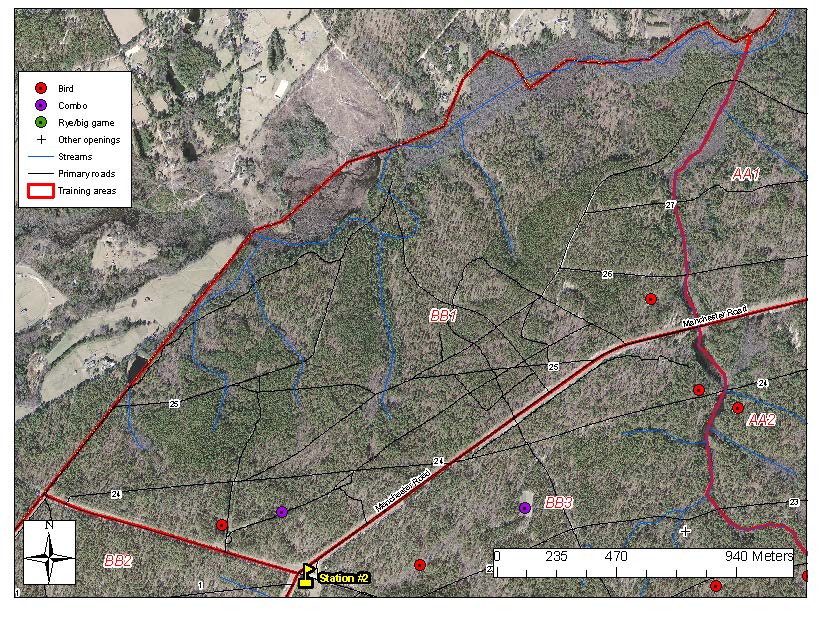
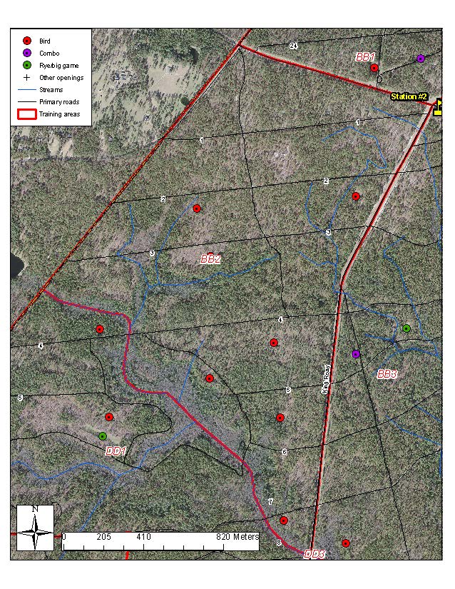
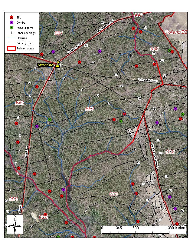
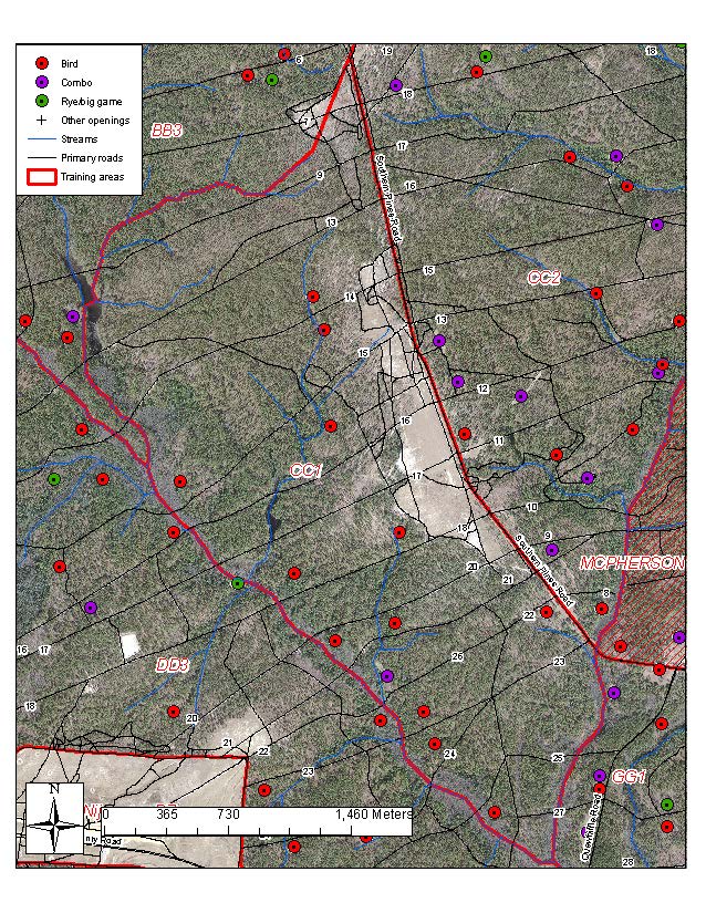
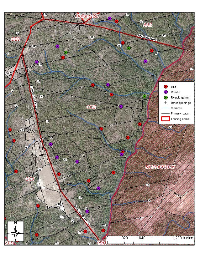
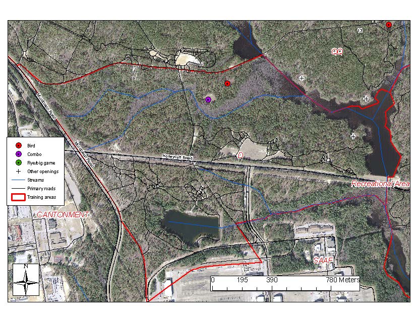
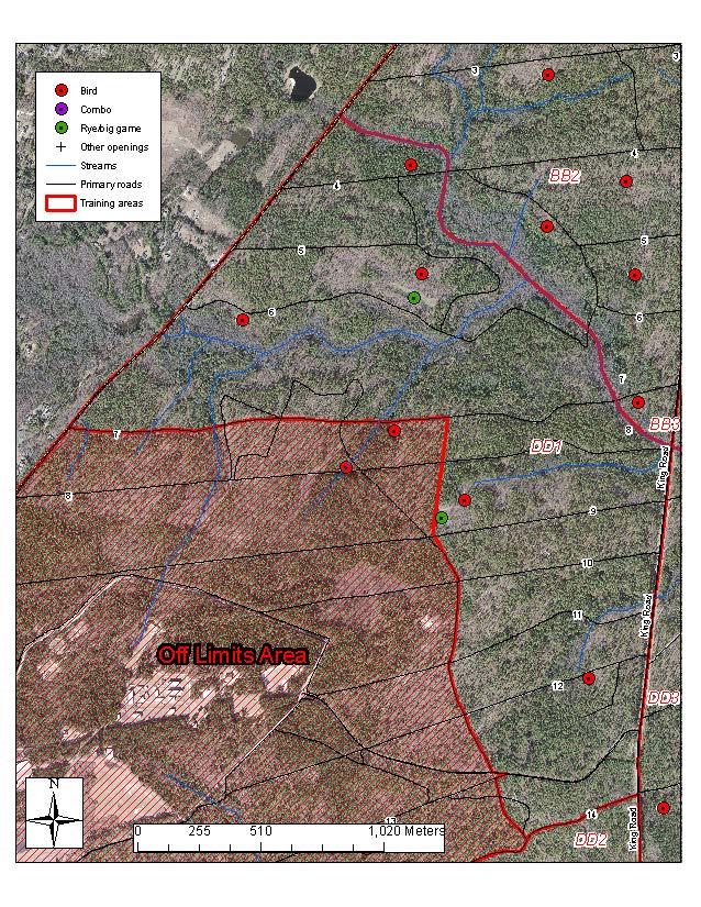
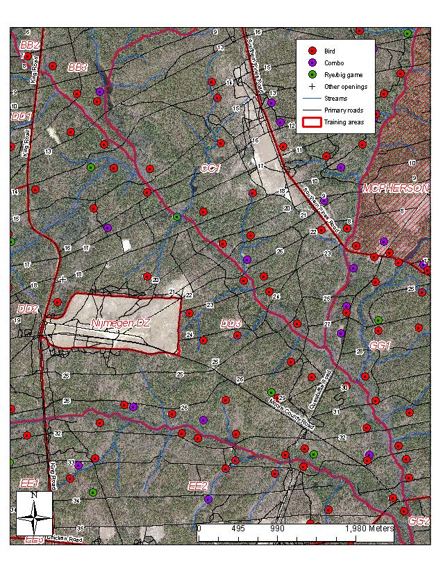
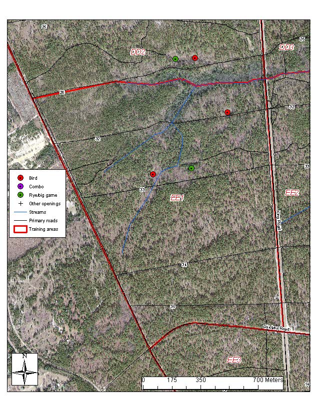
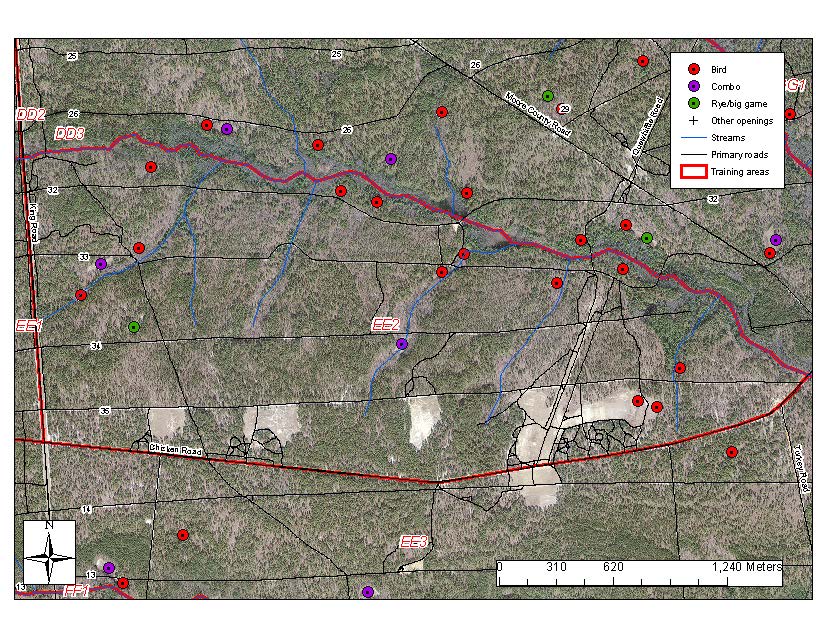
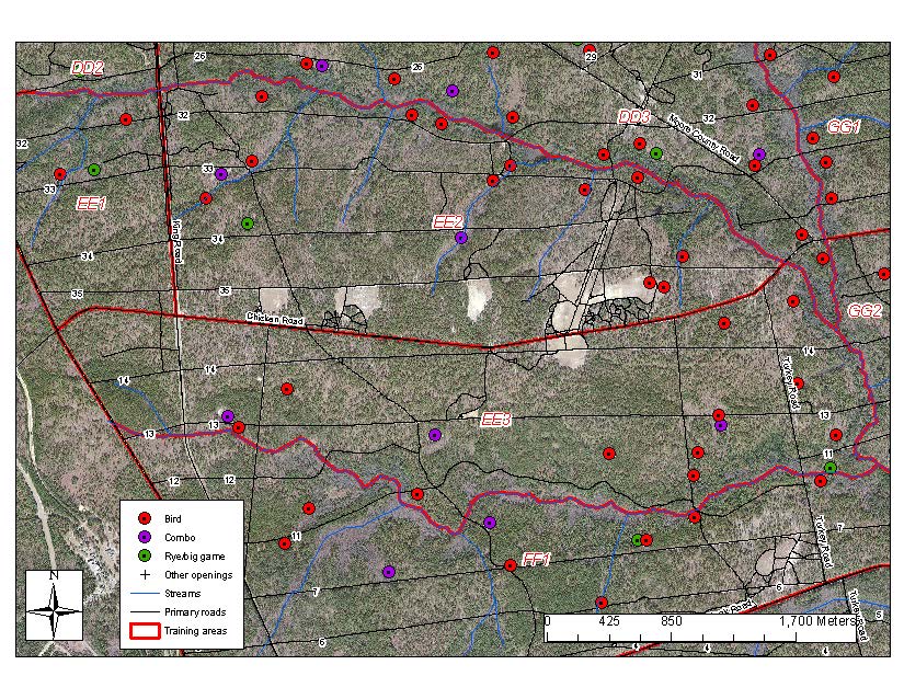
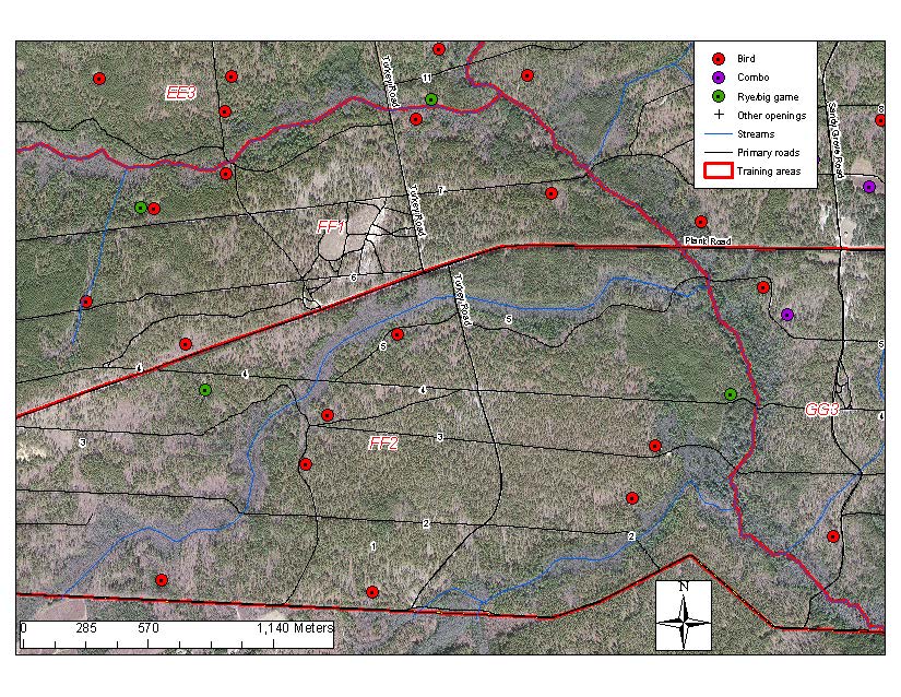
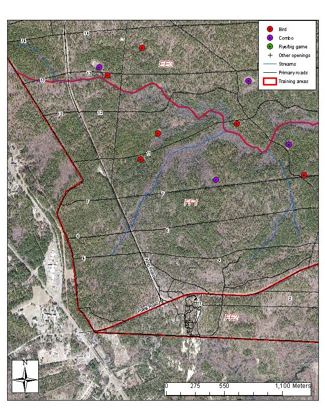
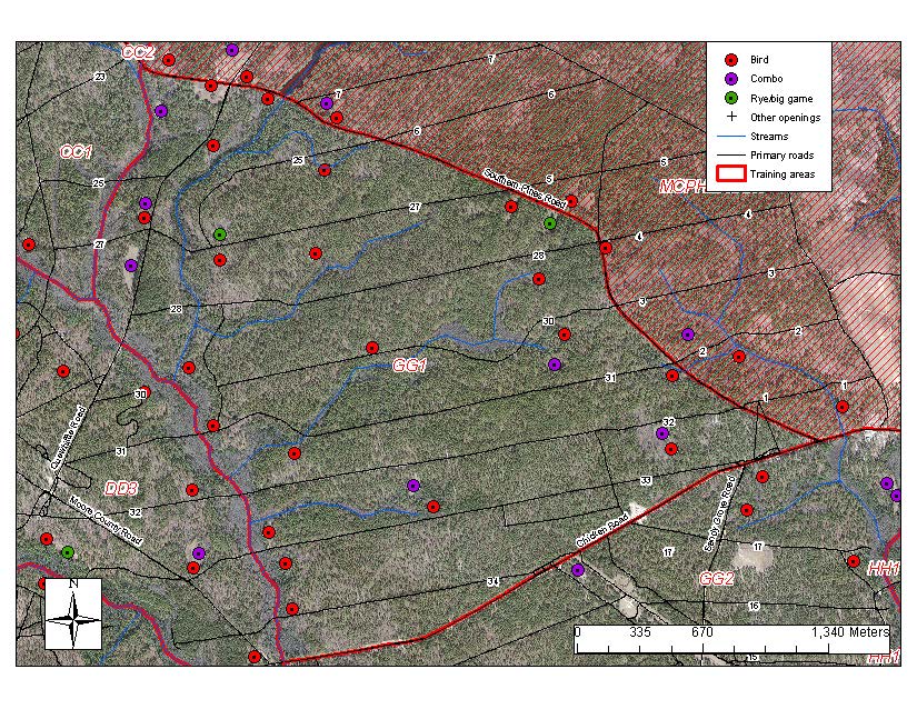
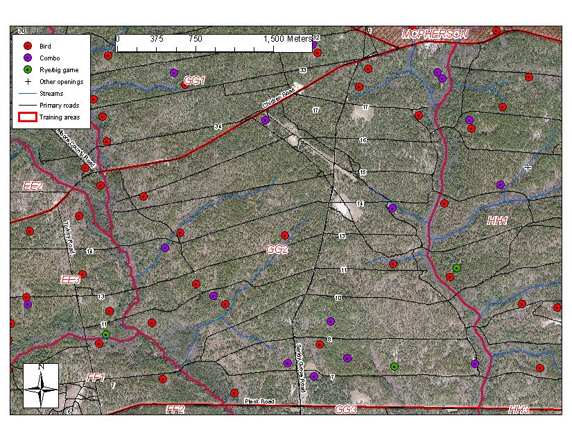
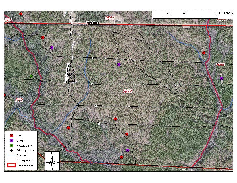
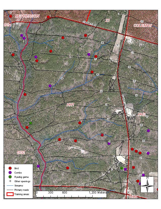
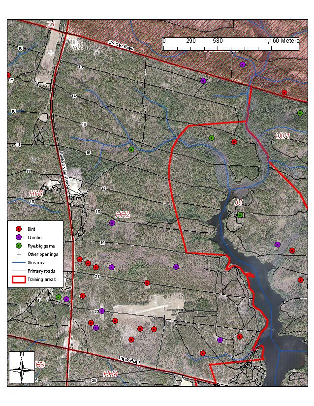
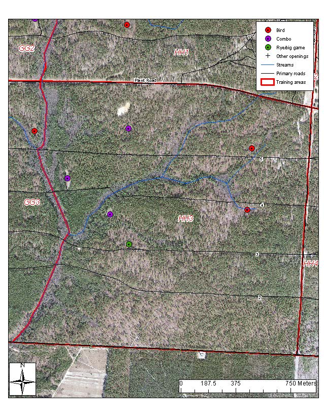
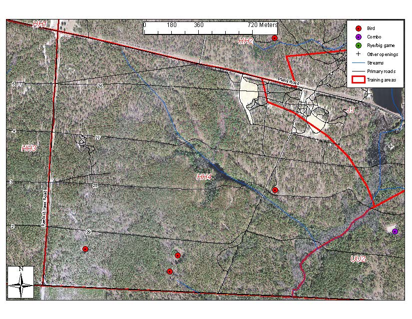
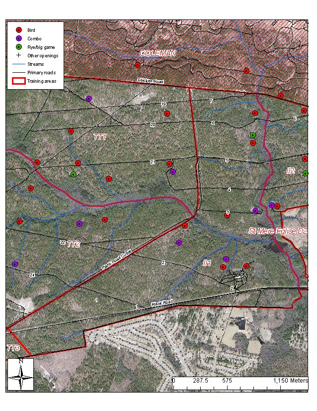
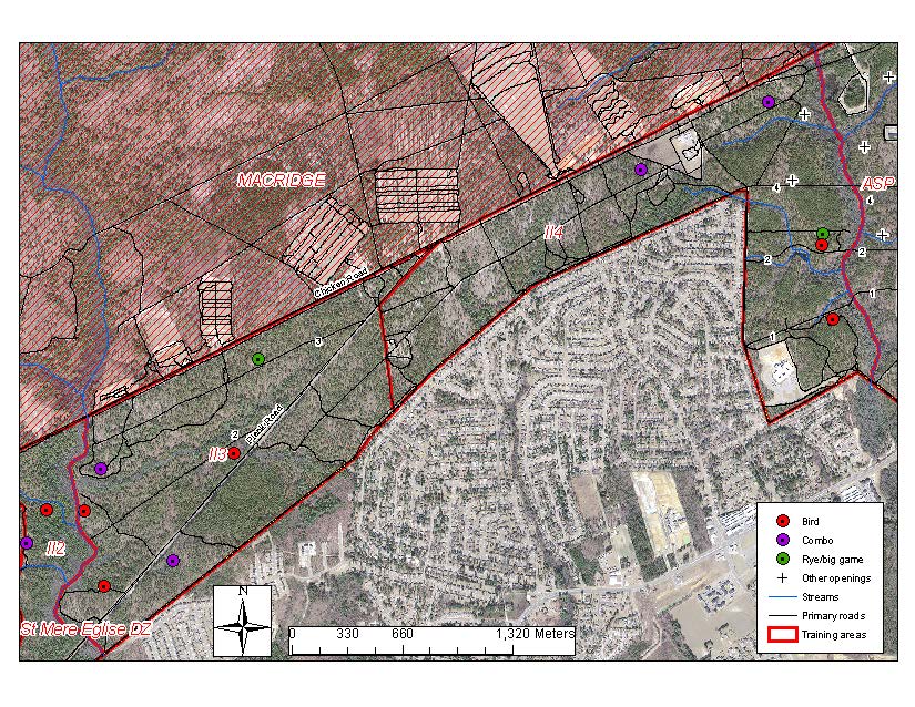
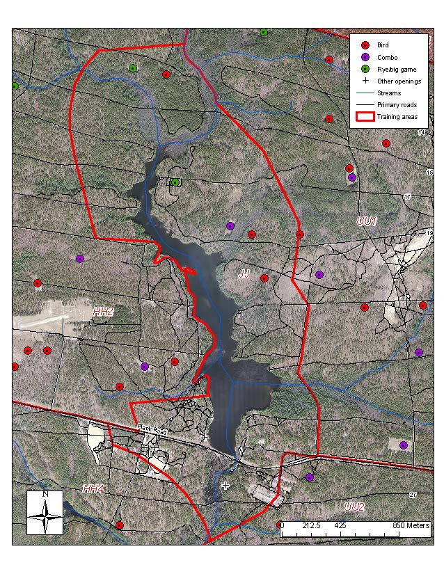
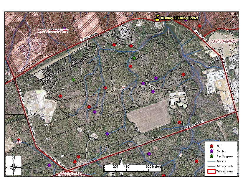
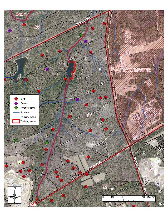
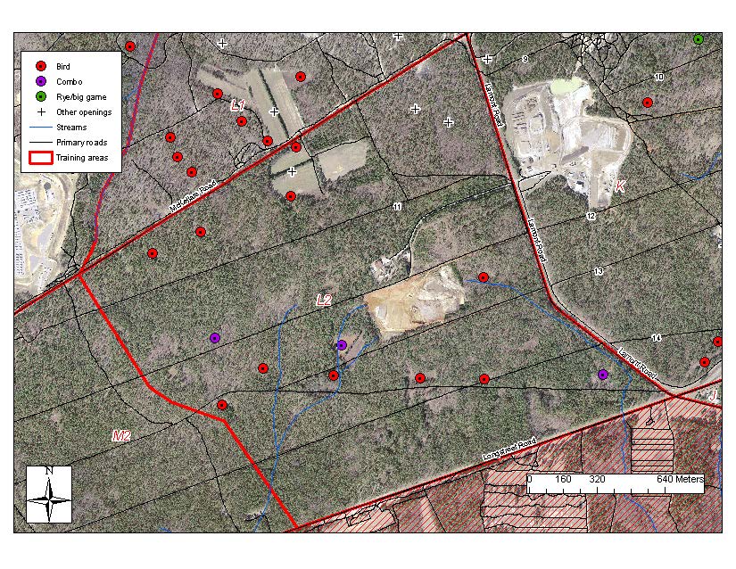
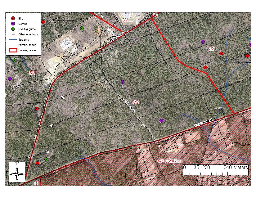
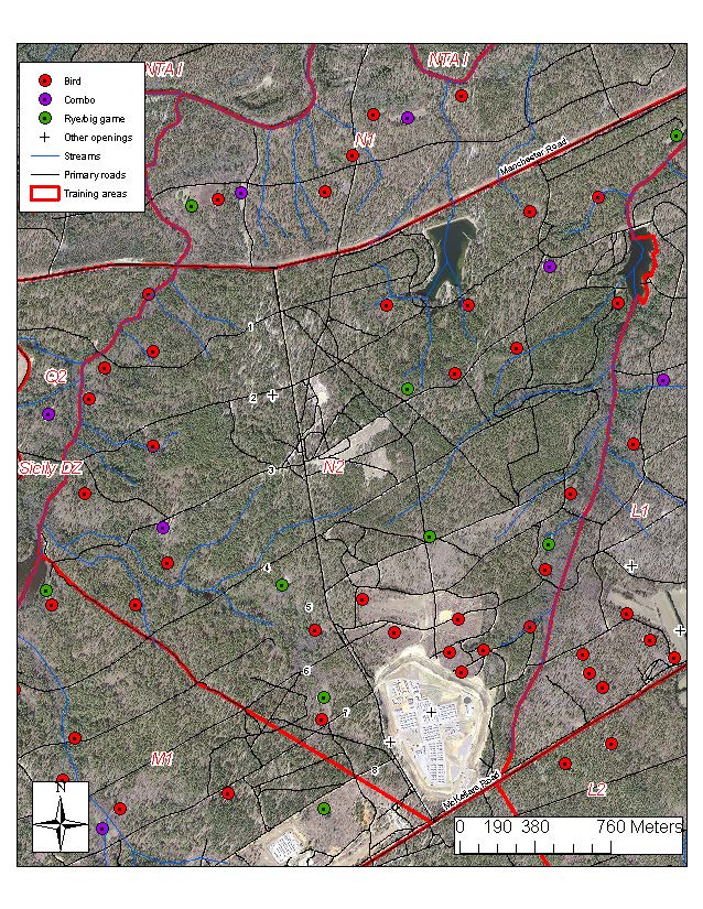
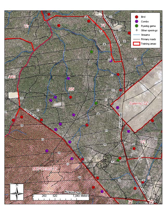
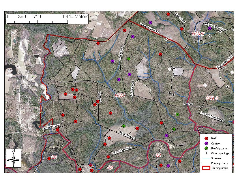
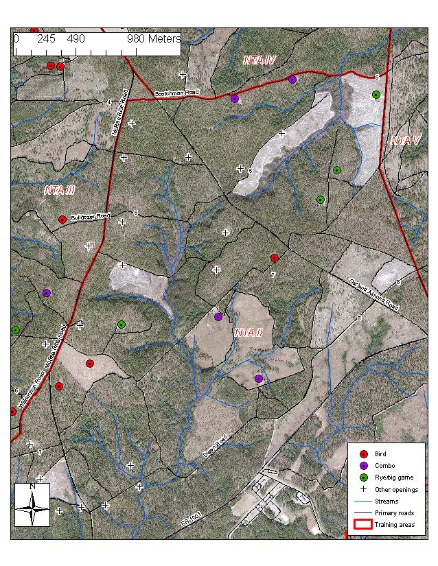
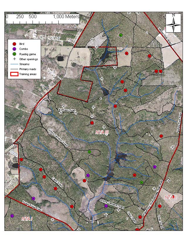
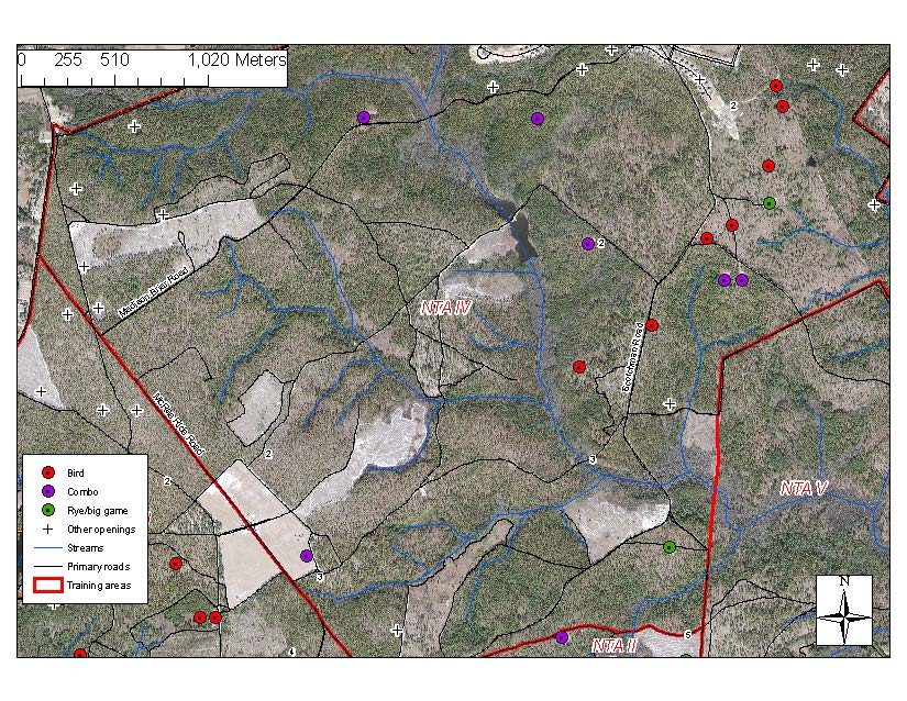
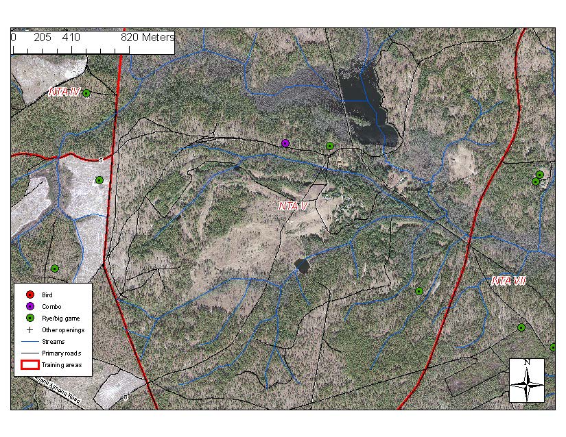
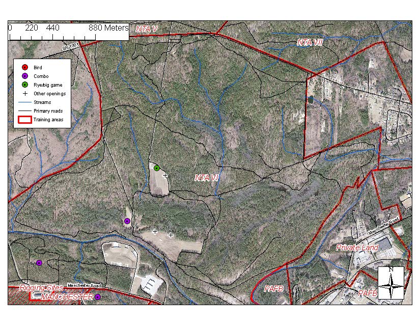
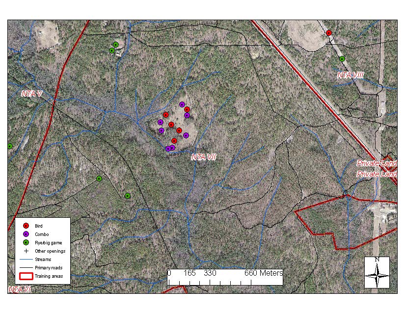
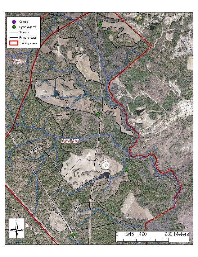
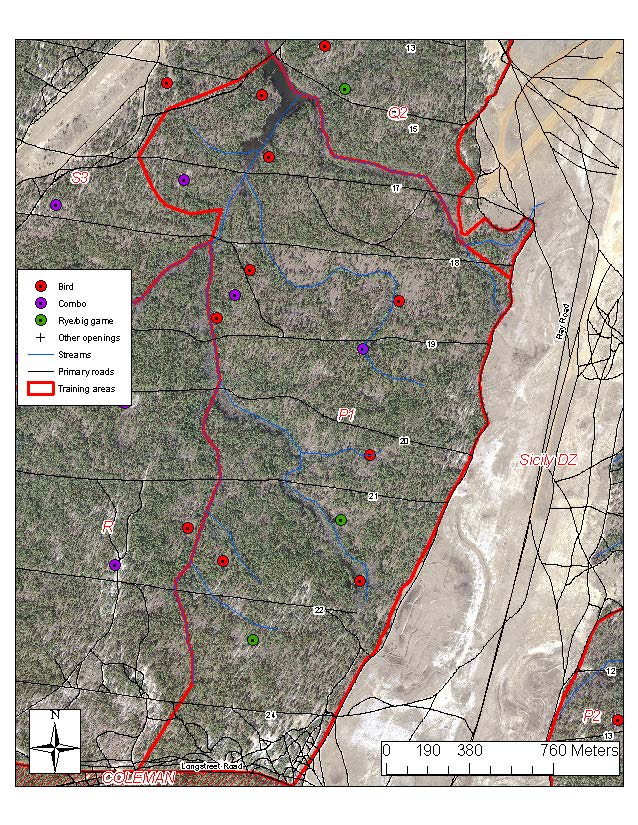
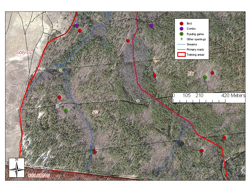
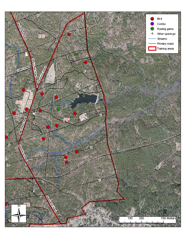
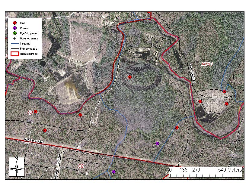
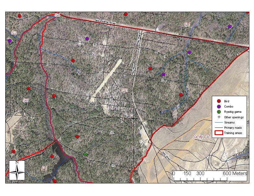
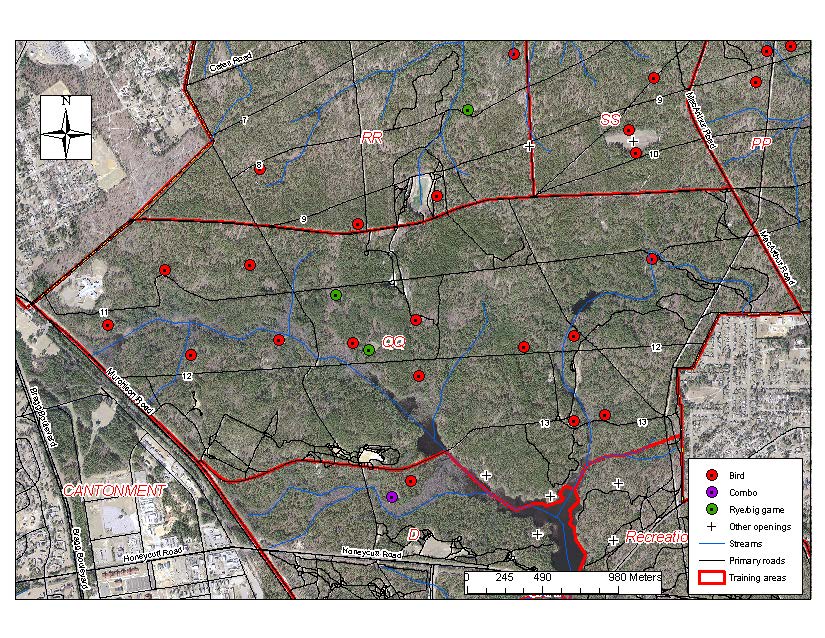
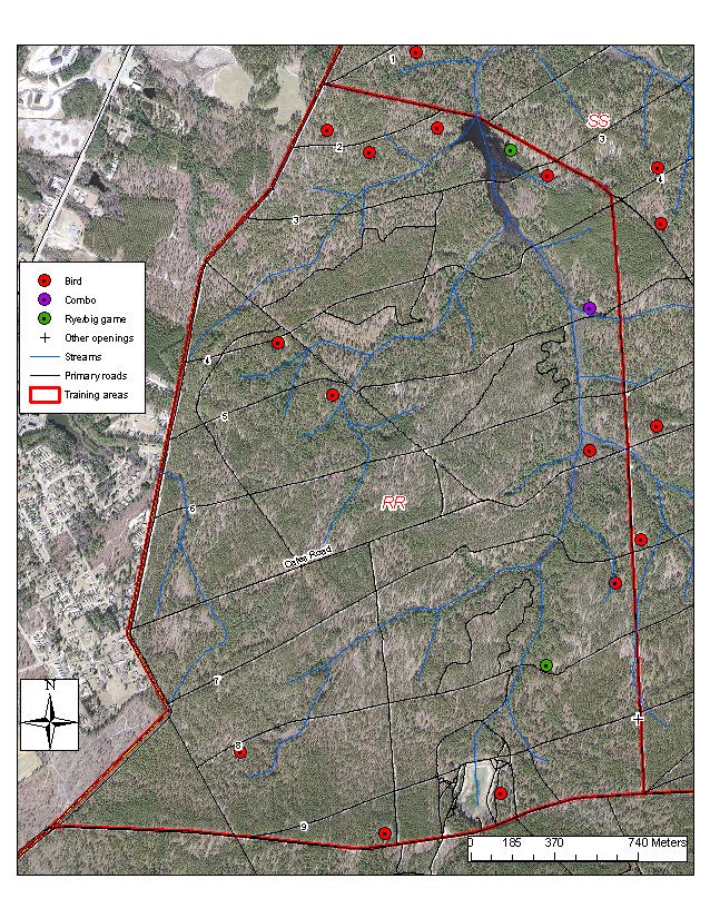
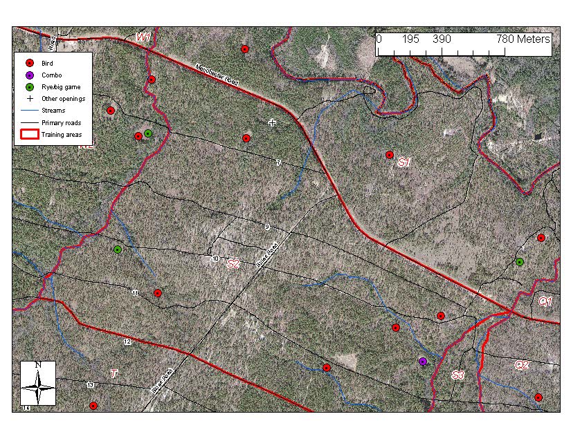
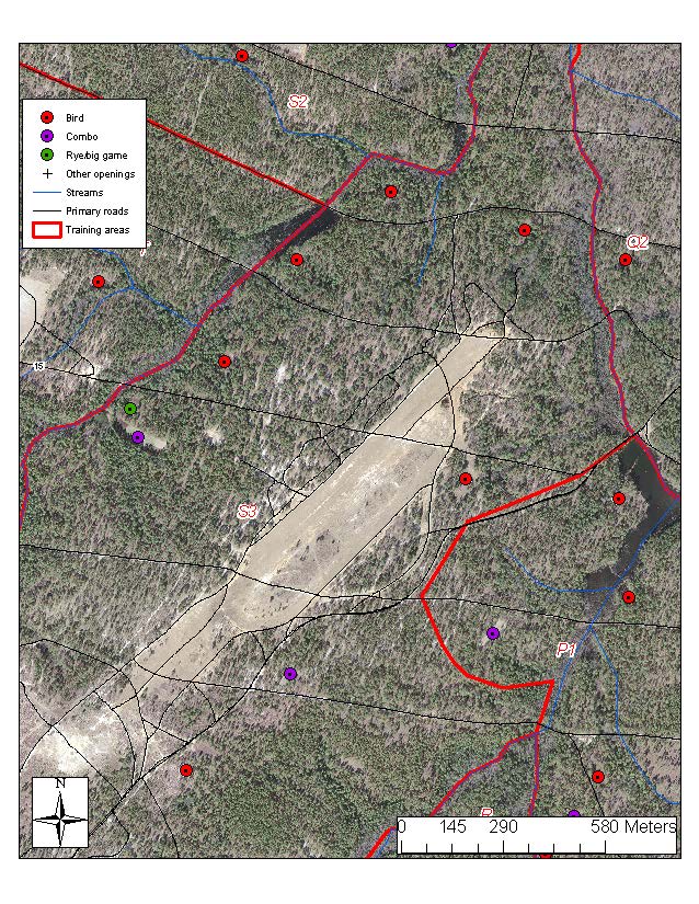
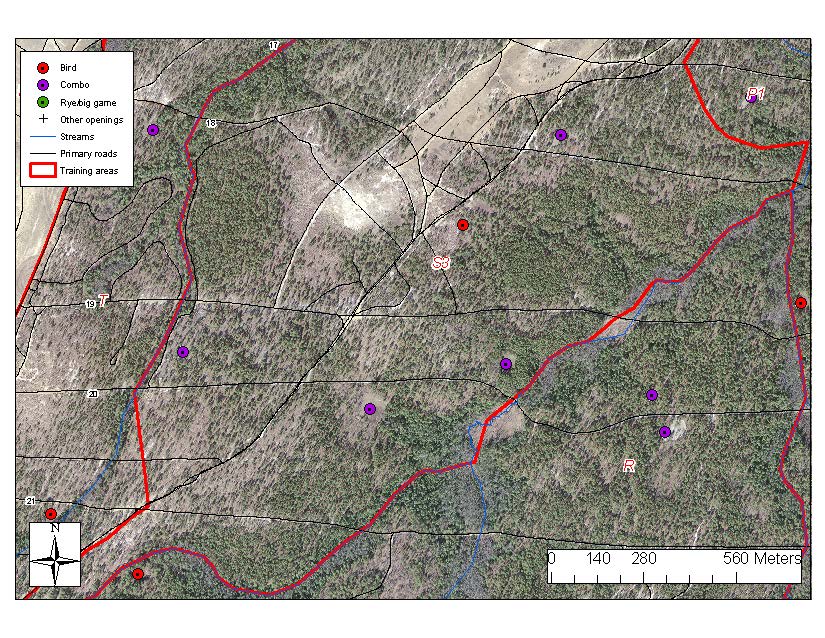
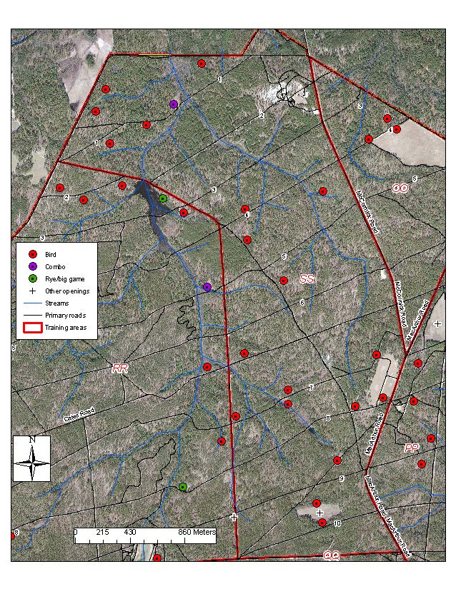
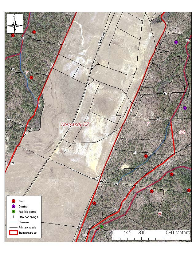
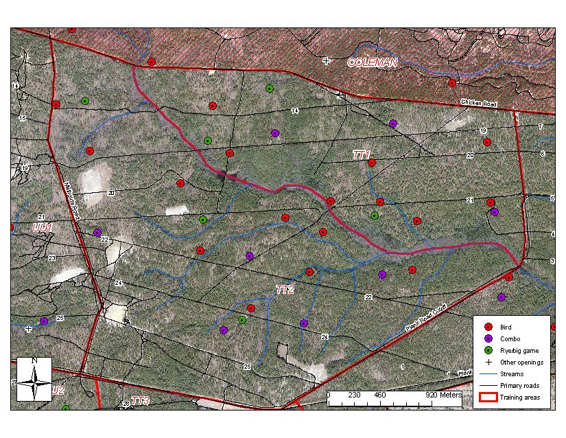
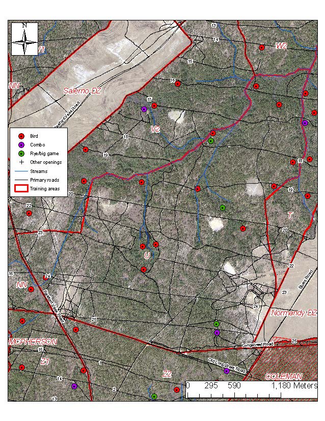
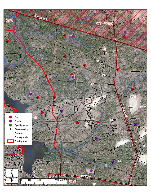
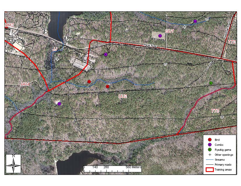
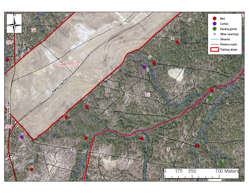
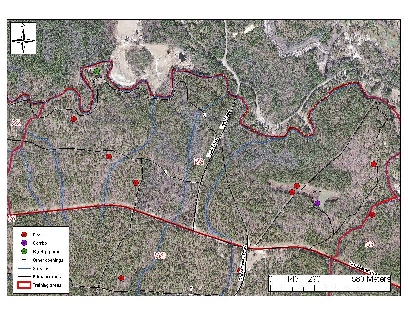
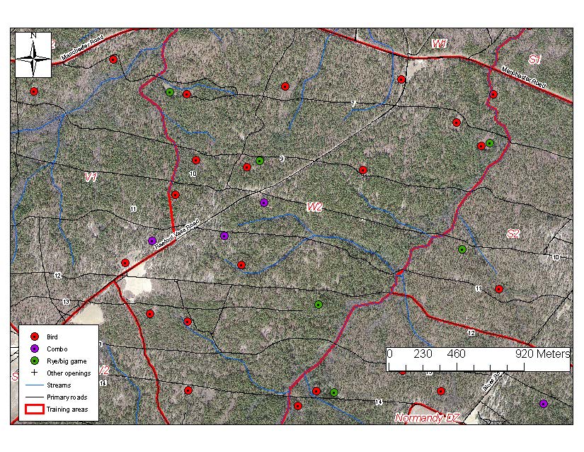
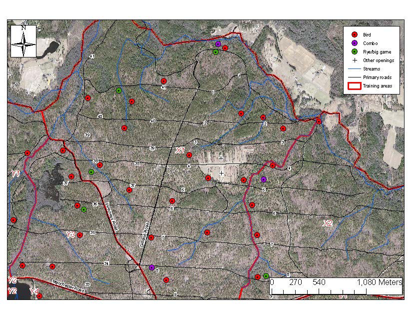
Food Field Locations
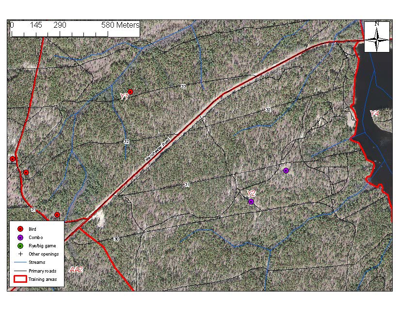
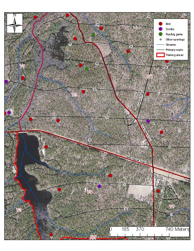
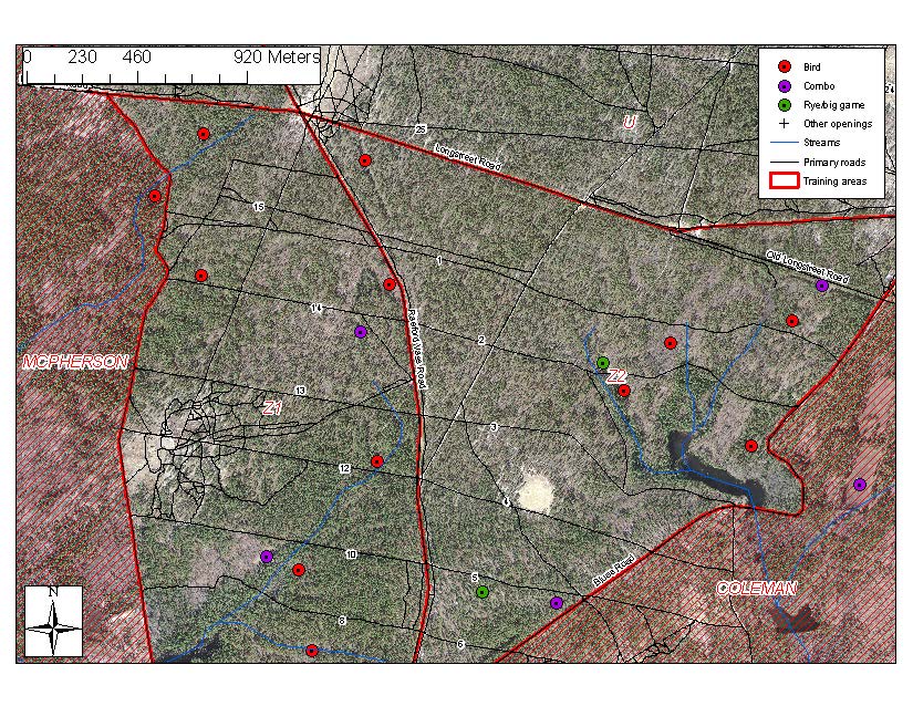
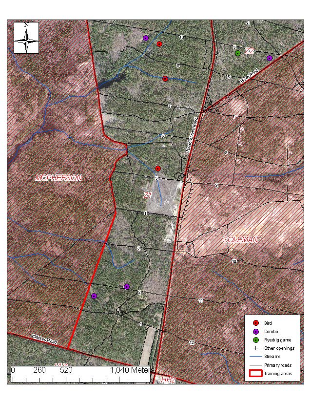
We've assembled individual JPEGs so you may review the spatial arrangement of food fields in lettered training and archery areas. The entire area may not be displayed on some maps. If that is the case, it simply means there aren't any fields in those sections.
SPECIAL NOTE:
Please keep in mind that most of our fields are on a two to three year planting rotation. Consequently, not every field will get planted every year. Also, these maps show only the locations of fields; not when they were last cultivated.
We believe that scouting is an integral part of hunting.
AA1 AA2 BB1 BB2 BB3 CC1 CC2 D DD1 DD2 DD3 EE1
EE2 EE2&3 FF East FF West GG1 GG2 GG3 H HH1 HH2 HH3
HH4 II1 II2 II3&4 J JJ K L1 L2 M1 M2 N1 N2 NN NTA1
NTA2 NTA3 NTA4 (prior to Linden Oaks) NTA5 (Croatan)* NTA6 NTA7 NTA8
OO P1 P2 PP Q1 Q2 QQ R RR S1 S2 S3 North S3 South
SS T North T South TT1&2 TT3 U UU1 UU2 V1 V2 W1 W2
X Y1 North Y1 South & Y2 Y3&4 Z1 North & Z2 Z1 South
*The area shown is that portion of NTA5 west of NC Hwy 87, and is part of Croatan Archery Area. There are no food plots in NTA5 east of 87.